Imagine having a high-resolution, detailed aerial map of your worksite, farmland, or property line – all captured quickly, safely, and at a fraction of the cost of traditional methods. This is the power of 2D drone mapping with Relative Accuracy, a service offered by Above and Beyond Imagery, empowering businesses across Wisconsin.
What is Relative Accuracy 2D Drone Mapping?
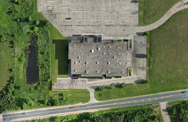
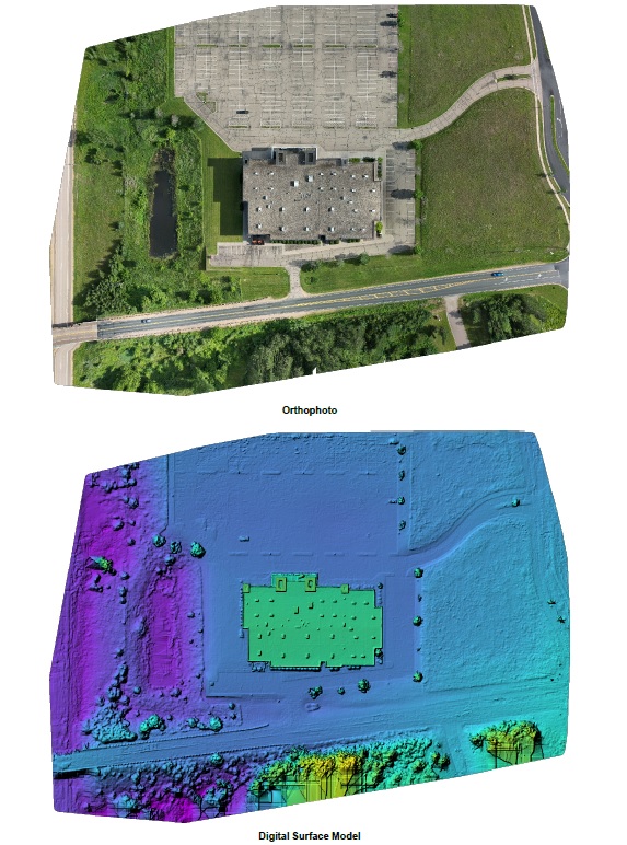
Our 2D drone mapping service utilizes unmanned aerial vehicles (UAVs) equipped with high-tech cameras to capture numerous overlapping aerial photographs. Specialized software then stitches these images together, correcting for distortion and variations in terrain, resulting in a georeferenced 2D orthomosaic map.
These maps boasts exceptional detail and provides a precise representation of your designated area. While not suitable for applications requiring absolute, centimeter-level precision, Relative Accuracy maps are perfect for a vast array of industries seeking a cost-effective and efficient mapping solution.
Unlocking Potential: Industries That Thrive with Above and Beyond Imagery’s 2D Drone Mapping
Here’s how our 2D drone mapping service with Relative Accuracy from Above and Beyond Imagery can empower various Wisconsin businesses:
Construction: Track construction progress, monitor stockpiles, calculate volumes, and ensure adherence to blueprints – all with high-resolution aerial imagery captured by Above and Beyond Imagery.
Agriculture: Gain valuable insights into field health by identifying crop stress, optimizing irrigation plans, and measuring crop yields with detailed 2D maps created by Above and Beyond Imagery.
Roofing: Conduct thorough roof inspections, generate accurate roof measurements for material estimation, and identify potential problems before they escalate – all from the safety of the ground.
Land Use & Development: Plan future projects with precise information on land features using 2D drone maps. Visualize potential development sites, and create detailed property maps for zoning applications.
Real Estate: Showcase properties with stunning aerial imagery captured by Above and Beyond Imagery. Create virtual tours for potential buyers, and accurately measure land areas for clear and informative listings.
Surveying & Engineering: Enhance traditional surveying methods by gathering aerial data quickly and safely with Above and Beyond Imagery’s 2D drone mapping. Calculate precise volumes for earthwork projects, and create detailed digital elevation maps.
Public Safety & Emergency Response: Get a clear aerial view of accident scenes or natural disasters with Above and Beyond Imagery’s 2D drone mapping service. Assist with search and rescue efforts, damage assessment, and planning for recovery initiatives.
Benefits Beyond the Map: Why Choose Above and Beyond Imagery for Your 2D Drone Mapping Needs?
Here’s what sets Above and Beyond Imagery’s 2D drone mapping apart:
- Cost-Effective: Compared to traditional surveying methods, our drone mapping offers a quicker and more affordable solution.
- Safety: Eliminate the risks associated with manned aerial surveys or ground surveying in hazardous areas.
- Speed & Efficiency: Capture vast areas of land in a fraction of the time compared to traditional methods.
- Accessibility: Reach previously inaccessible areas for data collection, overcoming terrain challenges effortlessly.
- Accuracy: Relative Accuracy maps from Above and Beyond Imagery provide highly detailed and precise measurements suitable for a wide range of applications.
Taking Flight with Your Vision: Above and Beyond Imagery, Your Trusted Drone Mapping Partner in Hudson, Wisconsin
At Above and Beyond Imagery, your Hudson-based drone mapping experts, we understand the unique needs of Wisconsin businesses. We offer a comprehensive 2D drone mapping service with Relative Accuracy, tailored to meet your specific project requirements.
Ready to unlock the potential of your land with high-resolution 2D drone mapping? Contact us today to discuss your project and learn how our drone mapping service can empower your business.